“Calibration is the poor step-child of remote sensing”
Many people still hesitate to use thermal imagery, because they feel they lack information on how to use it. In this episode of the Thermal Lens, Ellis Freedman, a consultant with over 20 years of experience including working in Landsat mission, and advising commercial companies, takes a deep dive into thermal missions. The subjects cover e.g.:
- What makes a thermal mission different from a mission imaging in visible spectral range?
- How do these differences influence the imagery?
- What is calibration, and why is it so important for the thermal sensors?
- What radiometry terms do users need to understand to work with thermal imagery?
This is the second part of a two-part-episode with Ellis. In the first part, we speak about what differentiates large agency missions from the emerging small commercial missions.
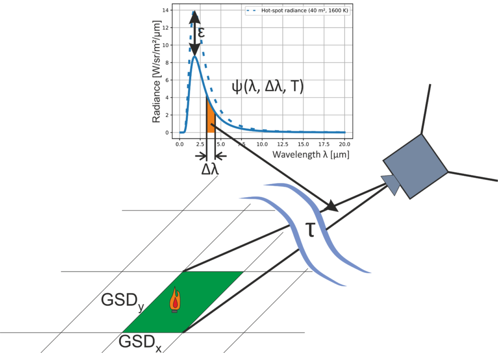
Source of the image: Soszynska 2021, (https://edoc.hu-berlin.de/handle/18452/23967)

Ellis Freedman is a physicist, and founder of Serious Science – a US based consulting company providing design and analysis support for satellite imaging systems. He has been Chief Engineer for the calibration of electro-optic sensors and the processing of raw data into imagery for large government and commercial remote sensing systems. His working experience includes working at NASA’s Landsat program. As a systems engineer, Ellis was involved in all mission aspects throughout his career. He has also served as a visiting lecturer on remote sensing payload design and IR phenomenology at Villanova University in the USA.
Find out more at http://www.serioussciencellc.com
Leave a Reply